VICERRECTORADO DE
INVESTIGACIÓN
VICERRECTORADO DE
INVESTIGACIÓN
ENGINEERING AND HERITAGE
RESEARCH GROUP
MENU
CLOSE
HOME
ABOUT
ENGINEERING & HERITAGE
MEMBERS
KEY PARTNERS & COLLABORATORS
PROJECTS
PUBLICATIONS
360 TOURS
STRUCTURAL HEALTH MONITORING
I+D+I SERVICES
Designed and developed by
ZP Technology
ENG
/
ESP
I+D+I
SERVICES
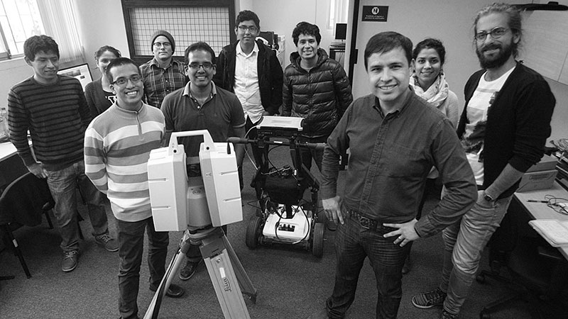
The research group Engineering & Heritage was created with the mission of developing innovative technologies for the conservation and monitoring of heritage buildings, with the multidisciplinary collaboration of professors, post and undergraduate students from the departments of Civil Engineering, Electronic Engineering and Archaeology.
The vision that Engineering & Heritage has for the future is to contribute to the knowledge used to preserve our heritage and let the future generations learn about our legacy.
Capabilities
- Geophysics essays to determine the general geotechnical conditions.
- 3D reconstruction with drones and laser scanner
- Digital topography
- Structural diagnosis using non-destructive essays
- Advanced Structural Analysis
- Structural and seismic monitoring
- Vibrations control
Sources of funding
- Innovate: Funds for the scientific equipment needed for the laboratories
- Concytec: Funds for the master scholarships in Civil Engineering
- PUCP: Funds for research projects (DGI)
Equipment available
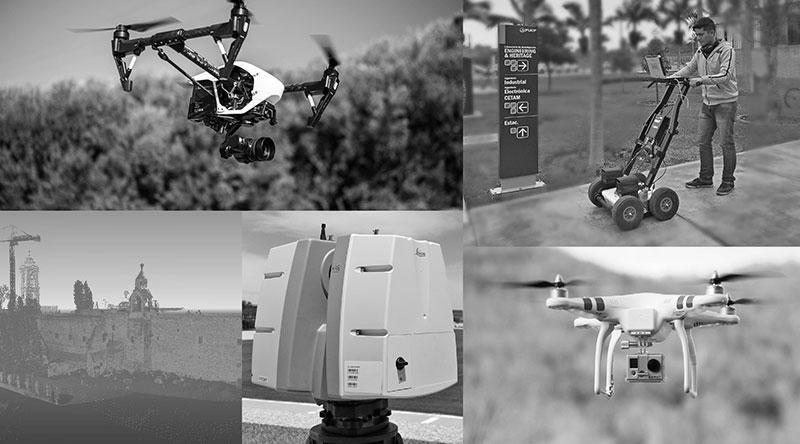
Non-tripulated flying system for geometrical reconstruction and 3D modelling
The laboratory is equipped with a fleet of non-tripulated flying vehicles (quadcopters y octocopters), equipped with high-resolution digital cameras and specialized software, that will capture images and videos that will after be used for geometrical and topographical reconstruction and 3D modelling.
Optical system to digital reconstruction and 3D modelling
The laboratory is equipped with a high-tech laser scanner that is used to build detailed and automatized geometric model of edifications. The data acquired with the laser scanner is processed by a software, that merges all the data collected, create animations and design digital 3D models. In addition, the laboratory has a postprocessing software that manipulates the laser scanned obtained data directly and generate solid models.
Equipment for the geophysical auscultation
This equipment is known as a Ground Radar with a broad fleet of antennas, that go from 100Mhz to 2Ghz, that allow you to explore surfaces that vary from 30m to 30cm of depth. The next step with this equipment is to generate 3D models of the analyzed area, this allows, with the right approach, identify buried or embedded objects within structural elements. Furthermore, the laboratory has the capability to conduct geophysical essays (multichannel analysis of surface waves (MASW), seismic refraction and micro-trepidations) and geotechnical exploration.
More
equipment
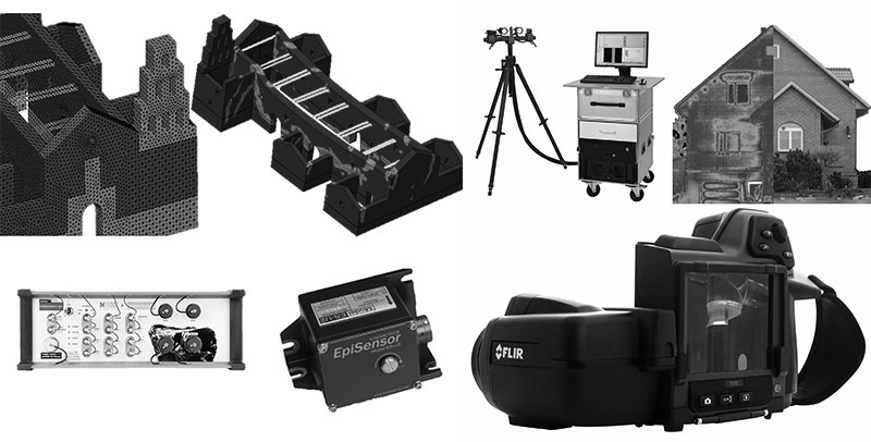
System to measure and monitor vibrations and deformations
This laboratory has a series of systems to acquire data and high sensibility acceleration transductors that allow the dynamic in situ essays in existing edifications. These systems grant the capability to study a vast amount of phenomenon related to vibrations and seismic instrumentation, thus providing the possibility to integrate and develop permanent monitoring solutions.
Diverse equipment used for diagnosis with non-destructive techniques
The equipment used for essays and non-destructive diagnosis of heritage buildings includes different types of tools and techniques. For example, systems that measure the internal state of wooden elements, a diagnosis system via thermography and an ultrasonic system for materials characterization.
Advanced analytic tools for the predictive structural analysis
We have the capacity to develop structural models with advanced analytic tools that study the behavior while under the influence of huge deformations, and even in collapse state, this is of special interest while studying heritage edifications. This way, we are able to develop predictive models to estimate the future behavior of these type of constructions; this, integrated with the information that is collected in the field with the previously shown techniques, allows the appropriate diagnosis and the development of optimized intervention proposals.